It starts like this: you come home one afternoon and notice your neighbor has planted a neat row of shrubs — right where your fence used to be. You both swear the land is yours. A few heated words later, you’re scrolling Reddit, reading about other homeowners fighting over inches of grass and tree roots. These property-line disputes are more common than people realize. In older neighborhoods, fences shift, hedges grow, and storm repairs blur the lines between lots. That’s where drone surveying is changing the game. It gives homeowners clear, high-resolution proof of what’s really on their land — before small misunderstandings turn into costly battles.
The Viral Tampa Dispute Everyone’s Talking About
A few days ago, a Tampa Bay homeowner posted a rant in a local Reddit thread. Their neighbor had trimmed back a hedge they’d planted years earlier, claiming it was “over the property line.” Comments poured in — some siding with the hedge owner, others insisting the neighbor was right. But among the chaos, one point stood out: no one could prove who was correct.
That post blew up because everyone could relate. So many homeowners assume the fence, driveway, or tree line marks the edge of their property. But in many cases, those visible features don’t match the true legal boundary. And when it’s your word against your neighbor’s, frustration builds fast.
Why “That’s My Fence” Isn’t Always the Truth
In Tampa, property boundaries can shift over time. Subdivisions built decades ago have records that don’t always line up with what’s physically there today. Add in hurricanes, construction work, or fence replacements, and it’s easy for boundaries to get blurred.
You might be surprised to learn that fences are often built inside the true property line to avoid crossing an easement. Driveways or patios sometimes extend beyond it after years of small repairs or additions. The problem? What you see isn’t always what’s written in your deed or shown in your plat.
That’s where a modern approach makes all the difference — one that combines surveying accuracy with aerial visuals anyone can understand.
How Drone Surveying Clears Up the Confusion

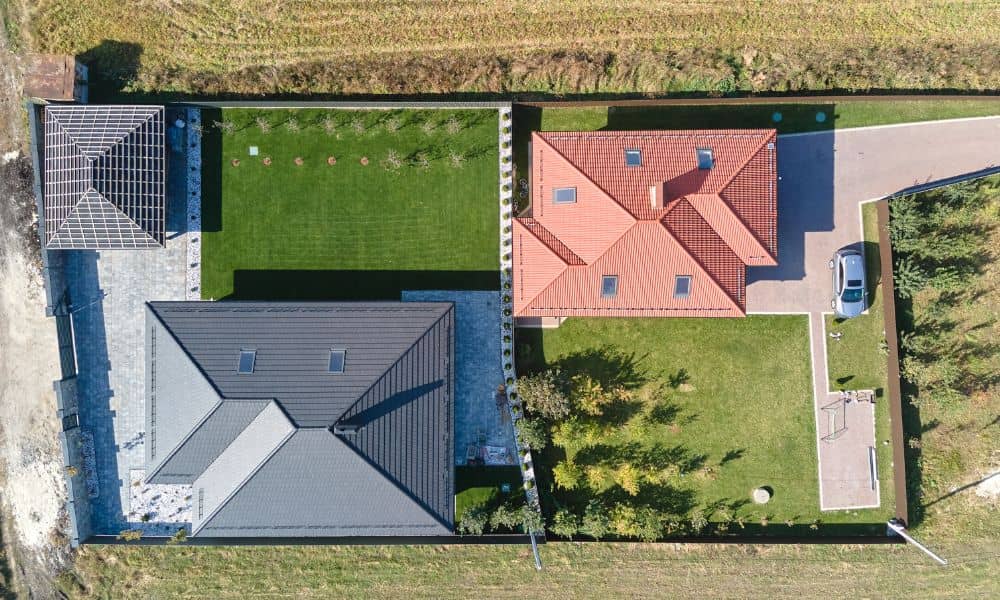
Traditional boundary surveys are essential, but they can feel abstract — lines, bearings, and coordinates that mean little to the average homeowner. Drone surveying, on the other hand, captures your property from above and creates a precise, bird’s-eye view that connects those legal lines to what you actually see on the ground.
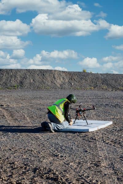
Here’s how it works in simple terms: a licensed land surveyor flies a drone over your property using GPS-guided precision. The drone collects thousands of images and elevation points, which are stitched together into a true-to-scale map. This map shows exactly where your fence, hedge, or patio sits in relation to your legal boundary.
The best part? You can see the difference. A clear aerial photo overlaid with your property lines leaves no room for doubt. When you show your neighbor that the hedge really is on your side — or isn’t — the conversation usually ends right there.
What Drone Surveying Can and Can’t Prove
Let’s be clear: drone surveying won’t decide who owns a piece of land in court. Only a full boundary survey prepared by a licensed surveyor can do that. But drones give a powerful layer of visual evidence that supports those official findings.
It can:
- Show where features like fences, trees, or driveways actually sit.
- Provide high-resolution proof of encroachments or overlaps.
- Create a clear timeline of changes if you capture before-and-after images.
It can’t:
- Change legal property lines.
- Determine ownership by itself.
- Replace an official boundary or title document.
Think of drone data as the visual language of surveying — it turns complex legal information into something easy to see, understand, and explain.
A Real Tampa Example
Last year, a homeowner in South Tampa hired a surveyor after storm repairs revealed their neighbor’s fence seemed “off.” The surveyor used drone mapping alongside traditional measurements. When they overlaid the images, the fence was clearly two feet over the line — something no one had noticed for years.
Instead of heading straight to court, the homeowner showed the visual map to their neighbor. It was clear, simple, and impossible to argue with. The neighbor agreed to move the fence back. What could’ve become a months-long legal battle ended with a weekend of cooperation.
That’s the power of combining technology with professionalism.
What to Expect if You Hire a Drone Surveyor
Hiring a surveyor who offers drone surveying isn’t complicated, but it helps to know what happens next.
First, the surveyor reviews your deed and existing plat to understand the property’s legal description. Then they’ll mark a few reference points on the ground for accuracy. The drone flight itself usually takes less than an hour, and processing the imagery can be done within a few days.
When it’s complete, you’ll receive a digital map showing your lot boundaries overlaid on a real aerial image of your property. You’ll see exactly where every hedge, fence, and feature stands — no guessing, no arguing, no surprises.
In Tampa, this is especially useful for homes near easements, older neighborhoods, or waterfront properties where boundaries can get tricky.
How It Helps Keep the Peace
Most neighbor disputes start from confusion, not bad intent. A clear map turns emotions into facts. It gives both sides something neutral to look at — and often, that’s all it takes to calm things down.
Drone surveying doesn’t just settle arguments, either. It helps you plan smarter. If you’re about to replace a fence, plant trees, or build a shed, getting a current drone map can save you from costly do-overs later. It’s also valuable documentation if you ever sell your property or need insurance proof after a storm.
The Takeaway
Homeowners deal with narrow lots, shared fences, and plenty of storm repairs. It’s no wonder property line arguments pop up every week online. But they don’t have to end badly.
With drone surveying, you can see your property exactly as it is — from the air, mapped with precision, and verified by a professional. It’s fast, affordable, and gives you peace of mind when small disagreements start to grow.
So before you plant that next row of hedges or point fingers at your neighbor’s fence, get the facts. Call a licensed land surveyor who uses drone technology. Because when proof comes from above, everyone can finally see eye to eye.