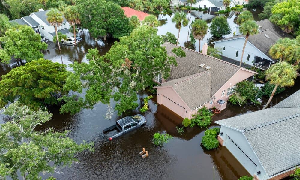
If you’ve ever been told that only part of your lot is in a flood zone, you already know the headache that follows. Insurance companies, lenders, and even neighbors may give you different answers about what this means. Some homeowners hear they must buy expensive flood insurance, while others are told they might not need it at all. That’s where a boundary survey becomes essential. It’s the tool that shows exactly where your property lines fall compared to FEMA’s flood maps—and it’s often the first step toward clear, confident decisions.
The Frustration of “Partial Flood Zone” Lots
Imagine buying a home and learning that just one corner of your yard touches the AE flood zone line. Your house itself is not in the zone, but your lender still says flood insurance is required. You’re left wondering: Is that really true? Or are you about to spend thousands on insurance you don’t actually need?
This situation isn’t rare. FEMA’s flood maps cover huge areas, and they don’t always match up neatly with property boundaries. As a result, homeowners can end up paying for risks that don’t affect their actual house. No wonder recent posts on Reddit show buyers venting about the confusion.
Why Lenders Default to “Yes”
From a lender’s perspective, requiring flood insurance is the safest option. If any portion of a lot touches the mapped flood zone, many banks simply say “yes, insurance is required.” They don’t have the time—or sometimes the information—to check whether the home itself is at risk.
That’s where homeowners feel stuck. They either accept the extra expense or try to fight it. Without clear documentation, though, it’s an uphill battle. Boundary surveys are the proof that helps you push back.
How a Boundary Survey Clears Things Up

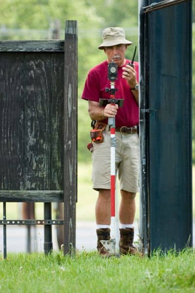
A boundary survey is more than a sketch of your lot. It is a signed, sealed drawing from a licensed land surveyor that shows your exact property lines, corners, and dimensions. When laid over FEMA’s flood maps, it answers the key question: Is the structure actually in the zone, or is it just part of the land?
If the survey shows that your house sits outside the AE area, you now have strong evidence to present to your lender. Combined with an Elevation Certificate, it can convince the bank that flood insurance should be reduced—or even waived.
On the other hand, if your home is inside the zone, the survey helps you plan realistically. Instead of endless debates, you’ll know exactly where you stand and what options you have.
Elevation Certificates and Why They Matter
Along with a boundary survey, an Elevation Certificate (EC) is another valuable tool. It provides details about your home’s elevation compared to the Base Flood Elevation (BFE). Lenders and insurers rely on this data when deciding insurance rates.
Before paying for a new EC, check whether one already exists for your property. In Hillsborough County, many older records are available online. If you can find an existing certificate, you may save both time and money.
When a LOMA Is the Next Step
What if your house is clearly outside the AE zone, but your lender still requires insurance? That’s when you may need a Letter of Map Amendment, or LOMA. This is FEMA’s way of officially correcting a map when a structure is wrongly shown in a flood zone.
The process sounds complex, but it’s not as bad as it seems. With a boundary survey, an Elevation Certificate, and the right supporting data—such as benchmarks and lowest adjacent grade—you can file online through FEMA’s LOMC portal. Many homeowners have used this path to remove mandatory insurance and cut costs dramatically.
Tampa’s Local Resources
Living in Tampa means dealing with both hurricanes and everyday heavy rain. That makes local resources especially valuable:
- Hillsborough County floodplain management office: They can confirm whether a prior EC exists.
- FEMA’s Online LOMC portal: A direct way to apply for a map amendment using your survey data.
- Licensed surveyors: Professionals who know the local terrain, floodplain quirks, and county requirements.
By starting locally, you avoid wasting time on unnecessary reports or duplicate surveys.
Real-Life Impact on Homeowners
Think about two scenarios:
- Scenario one: A buyer skips the survey and accepts their lender’s decision. They end up paying hundreds every year for insurance, even though the home is built higher than the floodplain.
- Scenario two: Another buyer orders a boundary survey and finds that only a sliver of their backyard is in AE. With the survey and EC in hand, they apply for a LOMA and get the insurance requirement removed. Over time, the savings far outweigh the survey cost.
The difference comes down to documentation. Without it, you’re stuck. With it, you have options.
Why Acting Early Matters
Don’t wait until closing week to ask these questions. If you’re under contract on a home, order your boundary survey early. It gives you time to gather records, check for existing Elevation Certificates, and, if necessary, file for a LOMA.
For current homeowners, the same advice applies. If you’re worried about flood insurance costs or planning to sell, get your documents in order now. Buyers will appreciate the clarity, and you’ll avoid last-minute surprises that can derail a deal.
Final Thoughts
Flood zones don’t always mean doom, but they do require clarity. When only part of your lot is in a mapped zone, the rules can feel unfair and confusing. A boundary survey is the first step to cutting through that fog. Combined with an Elevation Certificate and, if needed, a LOMA, it can save you money, lower your stress, and give you the peace of mind that your home is protected—without paying more than you should.