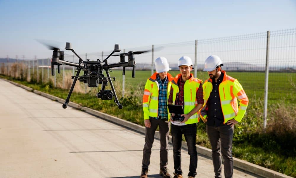
Drone surveyors are changing how people check property lines. Boundaries may look like small details, but they control where you can build, where fences go, and even how much land you can sell. Over time, markers can move, get covered, or even disappear. When that happens, drone surveyors make it easier to see exactly where those lines should be. They mix old survey skills with new drone tools to bring speed and accuracy to the job.
What Drone Surveyors Do
Drone surveyors are licensed surveyors who use drones as part of their work. Instead of walking every part of a property, they fly drones overhead to capture photos and maps. This makes it faster to line up what’s on paper with what’s on the ground.
In Tampa, where you’ll find both tight city lots and large rural tracts, this approach saves time. It also gives owners a clear view of their land. Drone surveyors don’t replace traditional surveying—they make it stronger.
Why Boundary Markers Matter
Boundary markers show where your land starts and ends. They may be stakes, rods, or concrete posts. Without them, problems come up fast.
Picture a neighbor putting up a fence, but part of it sits on your land. Or a builder starts a pool or deck that extends into county property. Fixing these mistakes later costs money and causes stress. For homeowners and developers, checking boundary markers is one of the best ways to protect property rights.
How Drone Surveyors Verify Boundary Markers

Drone surveyors use drones to confirm if markers are in the right place. Here’s how it works:
Aerial Mapping
A drone can map an entire property in minutes. These maps get compared with plats and deeds to check accuracy. For Tampa subdivisions and farms, this cuts hours of walking into a short flight.
High-Resolution Photos
Markers often hide under trees, grass, or fences. Drone cameras zoom in and make it easier to find them.
3D Models
With the data collected, drone surveyors can build 3D maps. These show slopes, low areas, and other land features. In flood-prone areas, this adds useful detail.
Faster Results
Traditional crews may spend days on a big property. Drone surveyors can finish much faster, keeping projects and sales on schedule.
Benefits of Hiring Drone Surveyors
Working with drone surveyors offers clear benefits:
- Accuracy – Combining aerial and ground data reduces mistakes.
- Proof – Photos and reports give you records for legal or insurance use.
- Savings – Faster surveys often mean lower costs.
- Confidence – You’ll know your property lines before building or selling.
Drone Surveyors and Traditional Surveys
Drone surveyors don’t replace the old ways. They still rely on plats, deeds, and ground markers. What drones add is another view that helps double-check the work.
In Tampa, where growth is quick and flood zones complicate things, this blend works best. Drone mapping speeds up the process, while ground checks make sure it’s right.
When to Call Drone Surveyors
You may not always need drones, but some situations make them worth it:
- Buying or selling property
- Sorting out disputes with neighbors
- Planning a new fence, pool, or addition
- Managing large tracts of land
- Re-checking boundaries after hurricanes or heavy rain
Storms often shift soil or hide markers. A quick drone survey brings clarity back.
Tampa’s Growing Need for Drone Surveyors
Tampa keeps growing with new homes, shopping centers, and road projects. Growth creates opportunity, but it also creates more chances for boundary problems. On top of that, flooding and storms make it harder to keep markers visible.
That’s why more people are turning to drone surveyors. From South Tampa to Carrollwood and Brandon, both homeowners and developers use them to confirm property lines. Drone surveyors help keep projects moving without delays or disputes.
Conclusion
Boundary markers may look small, but they carry real weight. They shape your property rights, guide your building plans, and protect your investment. Drone surveyors give property owners a faster and clearer way to confirm those markers.
By mixing aerial data with hands-on surveying, drone surveyors make sure boundaries are accurate and easy to prove. In a city shaped by fast growth and unpredictable weather, that peace of mind is hard to beat.